
Foreword
This article refers to the address: http://
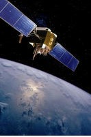
The GPS (Global Positioning System) GPS system is a high-precision, all-weather and global multi-function system for radio navigation, positioning and timing. It consists of a space part, a ground control part and a user part. GPS positioning is one of its functions. The plan began in 1973 and entered full operation in 1994.
GPS positioning refers to the use of the global navigation system to determine the ground position by receiving the satellite signal GSM wireless network, and transmitting the GPS determined ground position to some professional positioning platforms. It is a commonly used function in GPS technology applications. The central end uses fixed IP access to receive and process various data submitted by the GPS terminal through the mobile network, such as the current location information of the terminal, various alarm information of the terminal, etc. At the same time, it handles various query requests submitted by the client.
GPS positioning is a positioning technology that combines GPS technology, wireless communication technology (GSM/GPRS/CDMA), image processing technology and GIS technology. It can mainly realize the following functions: 1. Tracking and positioning 2. Track playback 3. Alarm (report) 4 Map making function 5. Mileage statistics 6. Vehicle information management 7. SMS notification function 8. Vehicle remote control 9. Car phone 10. Fuel consumption detection 11. Vehicle scheduling
GPS positioning method
The methods of GPS positioning are various, and users can adopt different positioning methods according to different purposes. The GPS positioning method can be divided according to different classification criteria as follows:
First, the observations used according to the positioning
For pseudorange GPS positioning, the observations used for pseudorange positioning are GPS pseudorange observations. The pseudorange observations used can be either C/A code pseudorange or P code pseudorange. The advantage of pseudorange positioning is that the data processing is simple, the requirements for the positioning conditions are low, and there is no problem of the whole week ambiguity, and the real-time positioning can be realized very easily; the disadvantage is that the accuracy of the observation value is low, and the pseudorange observation value of the C/A code is obtained. The accuracy of the P code pseudorange observation is generally about 30 centimeters, which results in low accuracy of the positioning results. In addition, if the P code pseudorange observation value with higher precision is used, there is also the AS. problem.
Carrier phase GPS positioning, the observation used for carrier phase positioning is the carrier phase observation of GPS, ie L1, L2 or some linear combination thereof. The advantage of carrier phase positioning is that the accuracy of the observation value is high, generally better than 2 mm; the disadvantage is that the data processing process is complicated and there is a problem of ambiguity throughout the week.
Second, according to the positioning mode
Absolute GPS positioning, also known as single-point positioning, is a mode of positioning using a receiver, which determines the absolute coordinates of the receiver antenna. This positioning mode is characterized by a simple operation method and can be operated in a single machine. Absolute positioning is generally used in applications where navigation and accuracy are not critical.
Relative to GPS positioning, relative positioning is also called differential positioning. This positioning mode uses two or more receivers and simultaneously observes a group of identical satellites to determine the mutual positional relationship between the receiver antennas.
Third, according to the time to obtain the positioning results
Real-time GPS positioning, real-time positioning is based on the data observed by the receiver, real-time solution to the location of the receiver antenna.
Non-real-time GPS positioning, non-real-time positioning, also known as post-processing positioning, is a method of performing post-processing on the data received by the receiver.
Fourth, according to the motion state of the receiver when positioning
Dynamic GPS positioning, the so-called dynamic positioning, is that when the GPS positioning is performed, the position of the antenna of the receiver is changed throughout the observation process. That is, at the time of data processing, the position of the receiver antenna is changed as an amount that changes with time. Dynamic positioning is divided into two categories: Kinematic and Dynamic.
Static GPS positioning, the so-called static positioning, is that when the GPS positioning is performed, the position of the antenna of the receiver is kept constant throughout the observation process. That is, at the time of data processing, the position of the receiver antenna is changed as an amount that does not change with time. In the measurement, static positioning is generally used for high-precision measurement and positioning. In the specific observation mode, multiple receivers perform static synchronous observation on different stations, and the time varies from several minutes, several hours or even tens of hours.
GPS positioning application
In real life, GPS positioning is mainly used for a technology for remote real-time location monitoring of mobile people, pets, cars and equipment. Due to the all-weather, high-precision and automatic measurement features of GPS positioning, as an advanced measurement method and new productivity, it has been integrated into various application fields of national economic construction, national defense construction and social development.
At present, goods such as logistics are lost, stolen or sent incorrectly. The positioning device can be used as a property tracker. Enable industry users, individual users and government users to grasp the geographic information of mobile assets in real time, and comprehensively improve the efficiency of mobile asset management and the safety monitoring coefficient. The tracker helps customers to more effectively use mobile resources for efficient operation, improve enterprise competitiveness, and maximize customer benefits.
In engineering measurement, the GPS static relative positioning technology is applied, and a precision engineering control network is set up for precision engineering such as land subsidence monitoring, dam deformation monitoring, high-rise building deformation monitoring, and tunnel penetration measurement in urban and mining areas. Encrypted mapping control points, using GPS real-time dynamic positioning technology (RTK) to map various scale topographic maps and for construction lofting.
In terms of aerial photogrammetry, China's surveying and mapping workers also use GPS technology to carry out various stages of aerial survey mapping, aerial photography flight navigation, airborne GPS aerial survey and other aerial survey mapping, as shown below.
In terms of geodynamics, GPS technology is used for global plate motion monitoring and regional plate motion monitoring. China has begun to use the GPS technology to monitor the Antarctic plate movement, the Qinghai-Tibet Plateau crustal movement, the Sichuan Xianshui River crust fracture movement, and the establishment of the China Crustal Deformation Observation Network, the Three Gorges Reservoir Deformation Observation Network, and the Capital Circle GPS Deformation Monitoring Network. GPS technology has been used for ocean surveying and underwater topographic mapping.
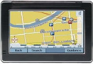
In terms of personal user equipment, GPS positioning is mainly to capture the satellites to be tested selected according to a certain satellite cut-off angle, and to track the operation of these satellites. When the receiver captures the tracked satellite signal, it can measure the rate of change of the pseudo-distance and distance of the receiving antenna to the satellite, and demodulate data such as satellite orbit parameters. According to these data, the microprocessor in the receiver can perform positioning calculation according to the positioning solution method, and calculate the latitude, longitude, altitude, speed, time and other information of the geographical location of the user.
to sum up
The application of GPS positioning in various aspects is very extensive, and the GPS technology will continue to strengthen and develop in the 21st century. This paper briefly introduces the concept of GPS positioning, positioning methods and application fields.
modern led crystal Table Lamp, with stainless steel and Top K9 crystals materials and unique designs, they are very popular in modern style rooms. It use the led light source which is energy saving and eye protecting. Modern crystal table lamp has many unique style and apperance.Its function is to focus the light in a small area, easy to work and study. Decorative table lamp appearance of luxury, material and style and diverse, light structure is complex, for the decorative effect of space, decorative and lighting functions as important.


Modern Crystal Table Light,Table Lamp,Crystal Table Lamps,Modern Table Lamps
Zhongshan Laidi Lighting Co.,LTD , http://www.idealightgroup.com